São Paulo Government Signs Agreement for Revitalization of Indigenous Transcontinental Route

Assinado Protocolo de Intenções com Governo de São Paulo para revitalização dos Caminhos de Peabiru
23 de junho de 2024
Ecossistema Dakila visita a Universidade Federal do Amazonas (UFAM)
1 de julho de 2024Development of the Peabiru Pathway Aims to Enhance Tourism and Sustainability.
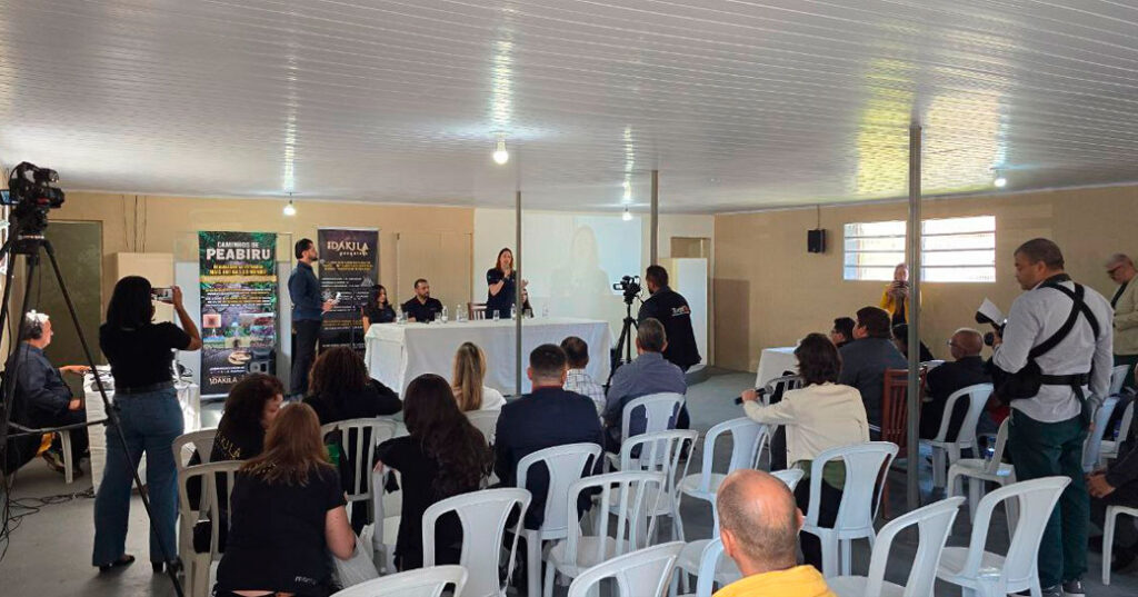
The São Paulo government, through the State Secretariat for Tourism and Travel (Setur-SP), signed a memorandum of understanding with the Dakila Research Association on June 21 at 12:00 PM to develop the Peabiru Pathway. This ancient indigenous transcontinental route, established long before European colonization, historically connected the Atlantic Ocean to the Pacific.
The agreement will initiate a collaborative effort to map cultural and scientific information about the pathway. The project aims to create a tourist route that includes historical attractions, adventure tourism, and nature-based tourism. It will also encourage the adoption of technology and innovation to support sustainable tourism and promote awareness of the Peabiru Pathway within the state. The route in São Paulo is estimated to stretch approximately 5,000 kilometers, spanning around 25 cities.

The Peabiru Pathway, a network of trails created thousands of years ago, links the Atlantic Ocean to the Pacific, passing through São Paulo, Paraná, and reaching Peru. In Brazil, this historic route, rich in stories and natural beauty, was used by various indigenous groups, including the Guarani and Kaingang peoples.
“We are reclaiming the history of Brazil’s indigenous peoples. São Paulo’s tourism sector, in partnership with Dakila and future collaborators, is developing a comprehensive tourism program. This partnership is crucial for the São Paulo government as it brings numerous benefits to the region and strengthens tourism across multiple segments,” said Roberto de Lucena, Secretary of Tourism and Travel.
Studies show that in São Paulo, the path began in São Vicente on the coast, crossed the city of São Paulo—including its historic center—traversed Sorocaba, reached the Cuesta de Botucatu region via the Tietê River, and passed through beautiful forests and streams before reaching the Paranapanema River. From there, it continued to Paraná, penetrated the Paraguayan Chaco, crossed Bolivia, surpassed the Andes, and reached Peru and the Pacific coast, eventually connecting to Europe.

The Peabiru Pathway also connects with Cananeia towards Paraná, traverses the Santa Catarina coast to the Itapocu River in Barra Velha, ascends through Jaraguá do Sul and Corupá, and continues through Paraná’s interior, Foz do Iguaçu, Paraguay, and into Bolivia and Peru, the heart of the former Inca Empire.
“Constructed following the planet’s magnetic grid, the pathway is essentially a map visible from above, with wide avenues and branches leading directly to various structures known today as star forts. Over 2,700 of these forts have been cataloged across all continents,” explained Urandir Fernandes de Oliveira, President of the Dakila Research Association.

Historically, this transcontinental route was also used for religious purposes, following the sun’s trajectory under the guidance of the Milky Way. Later, Europeans used the trail in their quest for gold and silver, playing a significant role in the colonization of southern Brazil by providing land access to various regions. Recent studies have shown that the Peabiru trails extended across the ocean, reaching as far as Mount Nemrut in Turkey.
Discoveries: Located 60 km from São Paulo’s capital, between the municipalities of São Lourenço da Serra and Juquitiba, researcher and President of the Dakila Research Association, Urandir Fernandes de Oliveira, identified a segment of the Peabiru Pathway in the Serra do Mar region, near BR 116. Marked by the distinctive “puxa tripa” grass and silos containing food and water for travelers, this site provided rest and resupply points. The Dakila Research team also identified a geoglyph in the area.
Follow our social media and stay up to date with the latest news: @dakilapesquisas | @ratanaba | @urandir_oliveira


